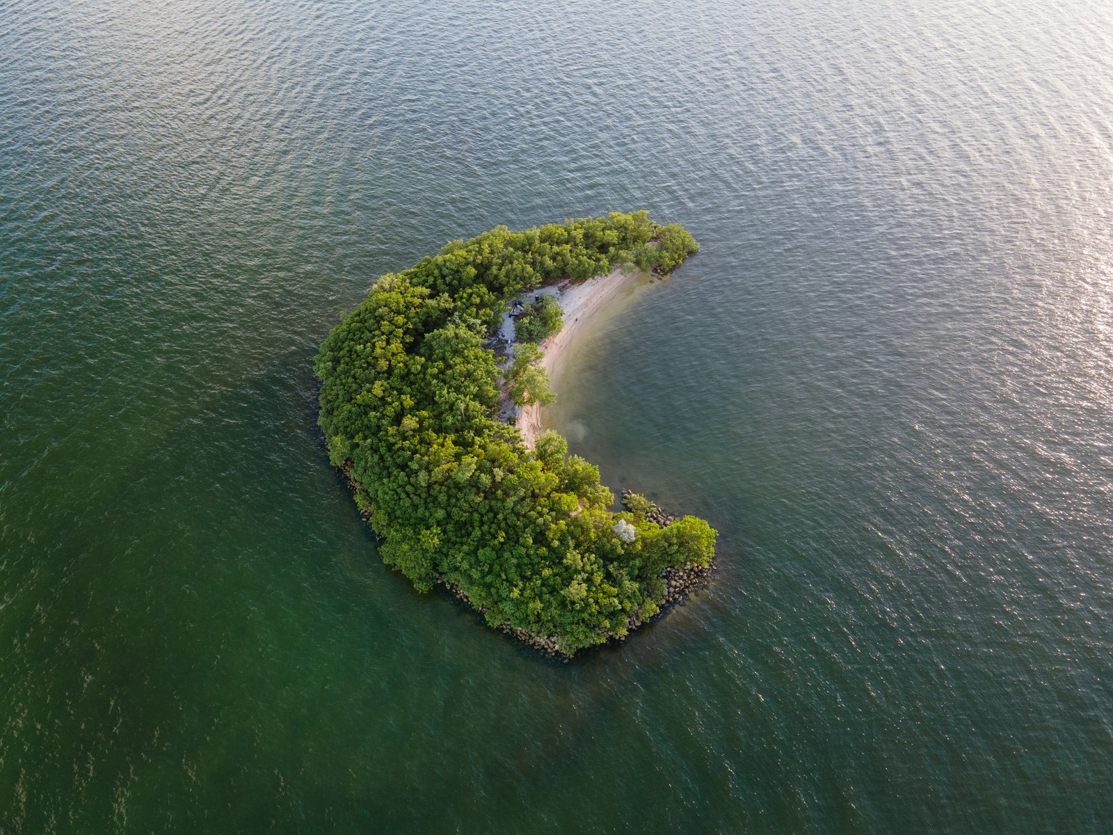
Drone photography offers a perspective that conventional ground-level photography cannot easily reproduce. From changing coastlines and forest canopies to wetlands, agricultural landscapes and urban development, aerial images can reveal patterns that are difficult to observe from the ground. These capabilities have made drones useful for visual storytelling, environmental documentation, land management and conservation research.
But creating a drone photography app focused on sustainability requires more than building a platform where enthusiasts can upload attractive aerial photographs. A successful community needs a clear purpose, useful features, responsible operating guidelines and safeguards that protect the environments being photographed.
The opportunity is to bring photographers, conservation practitioners, researchers and environmental enthusiasts together around a shared interest in aerial imagery while encouraging practices that minimise harm. Here are eleven considerations for developing a sustainable drone photography app and community.
1. Define the App’s Purpose and Environmental Value
Before choosing features or designing the interface, establish what the platform is intended to achieve. Is it primarily a photography community, an educational resource, a conservation storytelling platform or a place where drone operators can contribute useful environmental observations? These objectives can overlap, but they require different capabilities.
A photography-focused community may prioritise image galleries, portfolios and creative discussions. A conservation-oriented platform may need location verification, observation records, permissions and collaboration with environmental organisations. Defining the purpose early helps prevent the app from becoming an unfocused collection of features.
It also establishes what sustainability means within the platform. A community should not claim to support environmental protection merely because its members photograph natural landscapes. The environmental value needs to be reflected in how the platform operates and what it encourages users to do.
2. Understand the People Who Will Use It
Drone photography communities can include hobbyists, professional photographers, conservation volunteers, researchers, educators and commercial operators. Their needs are not necessarily the same. A beginner may want guidance on safe flying, camera settings and local regulations. A professional photographer may be interested in portfolio exposure and collaboration opportunities.
A conservation organisation may need carefully documented imagery that can support awareness campaigns or environmental monitoring. Before development, speak with potential users and identify their most important requirements.
Short interviews, surveys and prototype testing can help distinguish features people genuinely need from features that simply appear attractive in a product presentation.A focused first version is generally easier to test and improve than an app attempting to serve every audience immediately.
3. Build a Simple, Accessible User Experience
The interface should make it easy for users to discover photographs, understand their context and participate in discussions. Essential functions might include creating a profile, uploading images, browsing categories, following contributors and saving useful resources.
Images should be accompanied by meaningful descriptions rather than relying entirely on visual appeal. For example, an aerial photograph of a wetland could include information about the ecosystem, the photographer’s observations and any relevant conservation context.
Accessibility also matters. Clear navigation, readable text, appropriate colour contrast and descriptive image alternatives help make the platform usable by a wider audience. Because high-resolution aerial photographs and videos can consume significant data and storage, image compression and efficient media delivery should be considered from the beginning. A sustainable platform should also examine the digital resources required to operate its services.
4. Make Responsible Drone Photography a Core Requirement
A platform promoting environmental responsibility must address the potential environmental consequences of drone flights. Drones can disturb wildlife, particularly around nesting sites, breeding areas and sensitive habitats. Noise, proximity and repeated flights may affect animal behaviour even when the operator does not intend to cause harm.
The app should therefore provide clear guidance on avoiding wildlife disturbance and respecting protected areas. Users should be reminded that flight permissions, altitude limits, airspace restrictions and operating requirements vary by country and location.
In India, drone operations are subject to applicable aviation regulations and airspace restrictions. Operators should consult official sources, including the Directorate General of Civil Aviation and Digital Sky, for relevant requirements. The platform should not imply that a location is safe or legal to fly in simply because another user has uploaded a photograph from that area. Responsible photography sometimes means deciding not to fly.
5. Create a Community That Encourages Knowledge Sharing
Community features can distinguish a specialised photography platform from a general image-sharing service. Members could discuss aerial photography techniques, responsible flight planning, equipment maintenance and environmental storytelling.
Experienced operators might offer guidance to beginners, while conservation professionals could explain how aerial imagery is used in fieldwork. Discussion forums should be organised around useful subjects rather than relying entirely on popularity-driven feeds. Moderation is equally important.
Community guidelines should address harassment, copyright infringement, unsafe flight behaviour, misleading environmental claims and the sharing of sensitive information. Members should be encouraged to provide constructive feedback and credit the people or organisations whose work they reference.A community becomes valuable when participants learn from one another, not simply when the number of uploaded photographs increases.
6. Introduce Location-Based Features Carefully
Maps and location-based search can help users explore landscapes, environmental projects and photographic subjects. However, precise location information can create risks.
Publishing the coordinates of endangered species, nesting sites, sensitive habitats or vulnerable conservation areas may expose those locations to disturbance, unauthorised visits or exploitation. A responsible app should allow users to hide exact coordinates, share only broad geographic regions or remove location metadata from public uploads.
Certain locations may need to be excluded from public discovery features altogether.Map information should also distinguish between places that can be viewed online and places where drone operations are legally permitted.Location discovery should support environmental awareness without turning sensitive habitats into destinations for unrestricted aerial photography.
7. Provide Sustainability and Conservation Learning Resources
Educational content can give the app a purpose beyond photography. Resources might explain responsible flight practices, wildlife protection, landscape change, habitat restoration and the interpretation of aerial images.
Short tutorials could help users understand why certain environments are sensitive or how repeated aerial photographs can document visible changes over time.The platform could also invite conservation practitioners to contribute explanations of their work.
Information should be reviewed for accuracy, particularly when it concerns wildlife behaviour, environmental science or legal requirements.Where possible, resources should reference credible research institutions, regulators and conservation organisations.
This educational layer can help photographers understand the environmental context of the scenes they capture.
8. Encourage Meaningful Contributions Rather Than Upload Volume
Gamification can encourage participation, but poorly designed rewards may create unintended consequences. If users earn points for uploading more photographs, visiting new locations or completing frequent flights, the platform could inadvertently encourage unnecessary drone activity.
A sustainability-focused app should reward responsible contributions instead. Recognition could be given for helpful educational posts, constructive community feedback, verified conservation collaborations or well-documented environmental observations.
Photography challenges could also use existing image archives rather than requiring participants to conduct additional flights. The aim should be to recognise quality, usefulness and responsible behaviour.A successful community does not need to encourage more drone flights to demonstrate greater engagement.
9. Consider Live Feeds With Appropriate Safeguards
Live drone feeds could be an interesting feature for educational demonstrations, approved conservation projects or photography workshops. However, live broadcasting introduces additional safety, privacy and operational considerations.
A live stream should not distract an operator from maintaining safe control of the aircraft or meeting applicable flight requirements. The app must also consider whether footage could reveal private property, identifiable individuals or sensitive environmental locations.
For some activities, delayed broadcasts or edited recordings may be more appropriate than real-time feeds.Live streaming should therefore be treated as an optional, carefully controlled feature rather than an essential component of the initial app.
10. Build Partnerships With Conservation and Research Organisations
Partnerships can help connect the photography community with genuine environmental needs. Conservation organisations may be interested in aerial imagery for awareness campaigns, habitat documentation or specific monitoring activities.
However, environmental data collection requires appropriate methods, permissions and expertise. Photographs taken for artistic purposes are not automatically suitable for scientific analysis. Where research applications are involved, partners should establish clear requirements for image quality, flight procedures, location accuracy, data handling and permissions.
The app could provide a space where approved organisations explain their projects and invite appropriately qualified contributors.Such collaborations should prioritise the needs of the environmental project rather than using conservation primarily as a promotional theme.
11. Test the Platform and Measure Its Impact
Before launching widely, test the app with a small group representing different types of users. Observe how easily participants can upload photographs, find resources, manage privacy settings and understand community guidelines. Feedback should inform improvements to navigation, moderation and technical performance. Once launched, measure more than registrations and engagement.
Useful indicators include the number of active contributors, the quality of community discussions, educational resource usage, reported safety concerns and participation in approved environmental projects.If the app claims to support conservation, it should also explain how that contribution is evaluated.
For example, a partnership that produces useful imagery for an environmental organisation is a more meaningful outcome than simply accumulating photographs labelled as sustainable.Technical performance, storage requirements and operating costs should also be reviewed as the platform grows.
Can Drone Photography Support Environmental Sustainability?
Drone technology can support environmental work by providing aerial imagery for activities such as habitat assessment, vegetation monitoring, land-use documentation and conservation communication.In suitable circumstances, drones may reduce the need for certain conventional aerial surveys. However, they are not automatically the lowest-impact option.
Environmental outcomes depend on flight frequency, equipment, energy use, operational requirements and the alternatives available. Drone imagery also has limitations. Photographs may reveal visible changes in a landscape without explaining their causes, and observations may require verification through other methods.
A responsible platform should communicate these distinctions clearly.
Building a Community With a Purpose
The strongest opportunity for a sustainable drone photography app is not simply to create another social network for aerial images. It is to build a community where creative work, environmental knowledge and responsible technology use reinforce one another.
That requires thoughtful product design, credible educational resources, clear operating standards and careful handling of environmental and personal data. Start with a focused set of features, establish meaningful community guidelines and involve relevant experts before expanding into more advanced capabilities.
Aerial photography can help people see familiar environments differently. A well-designed community can help them understand what they are seeing—and why protecting those places matters.